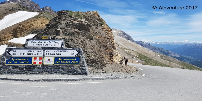
Cycling Col du Galibier from St Michel de Maurienne
Col du Galibier
19-12-2025
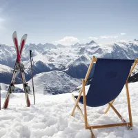
Cycling Col du Galibier in the French alps is one of the highest altitude alpine climbs at 2,642m with two routes available, this ascent from the North side (starting in the Savoie department of France) and the alternative South side ascent (from the Hautes Alpes department of France) via Col du Lautaret. The col has featured in many of the stages of the Tour de France over the years the latest being 2017 and also in amateur competitions such as the Marmotte Granfondo which occurs annually. The road is generally kept open from the end of May or early June until the end of October or beginning of November depending on snow fall. If you choose to ride this route early or late in the season it’s better to check if the road is open online before attempting the ascent.
Route details
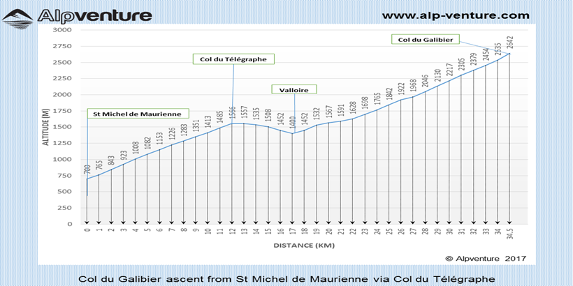
Distance (one way): 35km
Start altitude: 710m
Highest altitude: 2,642m
Start point: Saint Michel de Maurienne
Average gradients
Overall average: 5.5%
Saint Michel de Maurienne to Col du Télégraphe: 7.3%
Valloire to Col du Galibier: 7%
Route
Starting on main street in St Michel de Maurienne (road number D1006) turn right and follow the signs for Valloire / Col du Télégraphe / Col du Galibier (road number D902).
The ascent up to Col du Télégraphe is quite a steady gradient of just over 7% with most of the route on a tree lined road which can offer some shade on very hot days. There is a restaurant at the top of the col if needed.
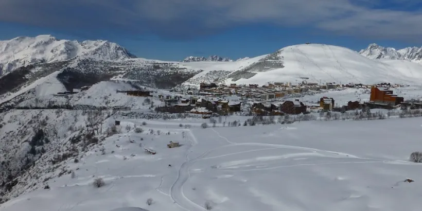
From the top of Col du Télégraphe you have about a 4km descent down to the ski resort of Valloire which offers a short break for your legs before the next climb. Valloire has some shops and restaurants available if required.
After descending to Valloire the climb starts with quite a gentle gradient for the first 5km then increases slightly for the rest of the climb with gradients ranging from 7% to 10%. There are a few water sources along the main road with the last one being located at a refuge 8km below the Col.
Near to the Col there is a road tunnel going through the mountain but to reach the summit you should follow the alternative road to the left of the tunnel. Depending on the time of the year this top section of road can be closed depending on the amount of snowfall on the summit.
There is a restaurant/snack bar before the Col on the North and South side if needed.
From the Col it is possible to descend down the South side to Col du Lautaret (altitude 2058m) which is around 8km below the summit. Turning left from Lautaret will take you to Briançon and turning right will take you towards Le Bourg d’Oisans.
Discover how private airport transfers to Club Med Alpe d’Huez make your journey smooth and convenient. Explore route options from Geneva, Lyon, and Grenoble, travel tips, and what to expect on arrival for the perfect ski holiday.
I cannot thank you enough for the brilliant communication and excellent service that you gave all my family in such difficult weather and traffic conditions.
Fantastic value for money!
Adam
Excellent transfer company
Everything done brilliantly. Booking was quick and easy, communication regarding pick up excellent. Liveried 8 passengers in a clean vehicle.


 Royalty
